

What is GNSS-based space weather?
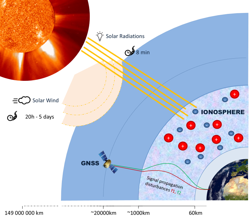
Space weather refers to disturbances originating from the Sun that can affect the Earth's upper atmosphere and the technologies we rely on every day.
Global Navigation Satellite Systems (GNSS) are particularly sensitive to these disturbances because their signals travel through the ionosphere, a region of the upper atmosphere that affects the propagation of GNSS signals. GNSS signals are also very weak when they reach the Earth's surface, making them vulnerable to interference from solar radio bursts.
⇒ GNSS are affected by space weather, but they are also used to monitor the near-Earth space environment and support research and operational services related to solar and ionospheric activity.
Why does the ionosphere matter for GNSS?
The ionosphere contains free electrons and ions created mainly by the Sun's radiation. The amount of ionization varies throughout the day, across seasons, and with the level of solar activity.
As GNSS signals travel through the ionosphere, free electrons delay their propagation, introducing errors in the GNSS positioning. Many single-frequency GNSS receivers use ionospheric models to correct for this effect.
During disturbed conditions, however, the ionosphere can change much more rapidly and strongly than these models can represent, leading to larger positioning errors.
⇒ Monitoring the ionosphere therefore provides valuable information about conditions that may affect GNSS applications.
How do we monitor the ionosphere?
Because the ionosphere affects the signal propagation depending on its frequency, its effect can be estimated with combinations of multi-frequency GNSS observations.
The ionospheric effect is related to the total amount of free electrons along the signal path. This quantity is called the Total Electron Content (TEC).
The ROB monitoring system uses observations from hundreds of GNSS stations of the EUREF Permanent GNSS Network (EPN), which continuously tracks multi-frequency signals from several satellite constellations (GPS, Galileo, GLONASS, BeiDou...).
⇒ By combining these measurements across Europe, ROB produces near real-time maps of vertical TEC (vTEC) over Europe, and monitors the ionospheric variability and space weather activity.
What is VTEC?
Vertical Total Electron Content (VTEC) is a measure of the total number of free electrons in the ionosphere above a given location. It is commonly expressed in TECU (Total Electron Content Units), where:
1 TECU = 1016 electrons per square metre.
To distinguish normal day-to-day variations from potential space weather disturbances, current VTEC values are compared with their average conditions observed during the previous 15 days.