

Contact: iono@oma.be
The ionospheric Vertical Total Electron Content (VTEC) is extracted from the near-real time European TEC maps at 3 different locations (Figure 1):
- Northern part of Europe (lon: 5°; lat: 61°, top)
- Brussels (lon: 4.5°; lat: 50.5°, middle)
- Southern part of Europe (lon: 5°; lat: 36°, bottom)
To monitor ionospheric conditions and space weather effects over time:
- Figure 2 on the left compares the current VTEC with its recent background behaviour represented by the 15-day VTEC median and standard deviation, together with the 5-minute VTEC variability.
- Figure 3 on the right highlights ionospheric disturbances through the VTEC absolute deviation and VTEC relative deviation from the 15-day median.
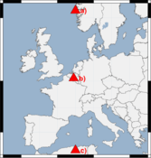
Figure 1: VTEC extracting point locations
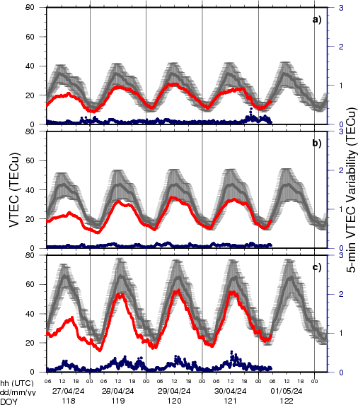
Figure 2: Time Series of the VTEC, the 15-day VTEC median and the 5-min VTEC variability in the North, Mid- and South of Europe
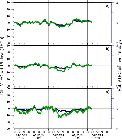
Figure 3: Time Series of the VTEC differences and VTEC differences w.r.t. 15-day VTEC median in the North, Mid- and South of Europe