
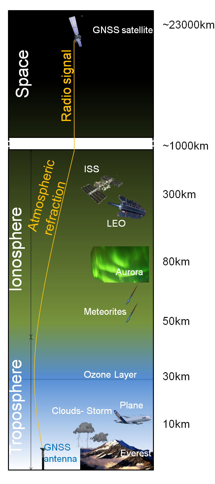
Atmospheric remote sensing using GNSS
The Royal Observatory of Belgium (ROB) exploits observations recorded by continuously operating Global Navigation Satellite System (GNSS) stations for the study and the monitoring of the low Earth's atmosphere (referred to as troposphere). These stations typically belong to international observing networks such as the EUREF Permanent Network (EPN) [Bruyninx, 2004] and to the International GNSS Service (IGS) [Dow et al, 2005] network or national GNSS networks such as the FLEPOS and WALCORS networks in Belgium.
ROB analyses these observations to provide products and services that inform users on the amount of water vapour contained in the troposphere above these stations. These products and services are particularly useful in the field of meteorology and climate.
This research is carried out in the frame of the Solar-Terrestrial Centre of Excellence (STCE) which is a project funded by the Belgian Federal Science Policy (BELSPO).
GNSS-Meteorology
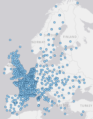
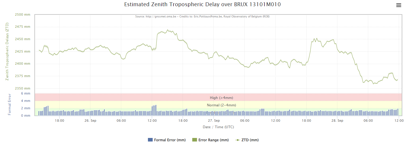
In the context of meteorology, water vapour is a key observation that helps meteorologists to forecast properly the weather. To support Belgian and (pan)-European meteorologists in their weather prediction, ROB operates a 24x7 analysis centre and participates in the European EUMETNET EIG GNSS water VApour Program (E-GVAP) to provide European National Meteorological Services (EUMETNET) members every hour with ground-based GNSS tropospheric Zenith Total path Delay (ZTD) estimates from a large set of GNSS stations (See Figures below). These ZTD estimates contain the necessary information on the amount of water vapour above the GNSS stations to be ingested in national, regional, and global weather models to enhance operational weather forecasts.
GNSS-Climate

Some permanent GNSS stations have today continuous observations for 25-30 years. ROB reanalyses the observations recorded in these GNSS stations to achieve long-term ZTD datasets that can be used to study and monitor the amount of atmospheric water vapour for climate purposes.
The long-term evolution of the water vapour content is indeed closely related to the evolution of the atmospheric temperature through the Clausisus-Claperon relationship, hence it is a key parameter to provide observational insights in the perspective of climate warming.
In that context, ROB closely collaborates with the Royal Meteorological Institute (RMI), international institutes, and is ready to support the recently established Belgian Climate Centre with tailored observational datasets.