
Introduction
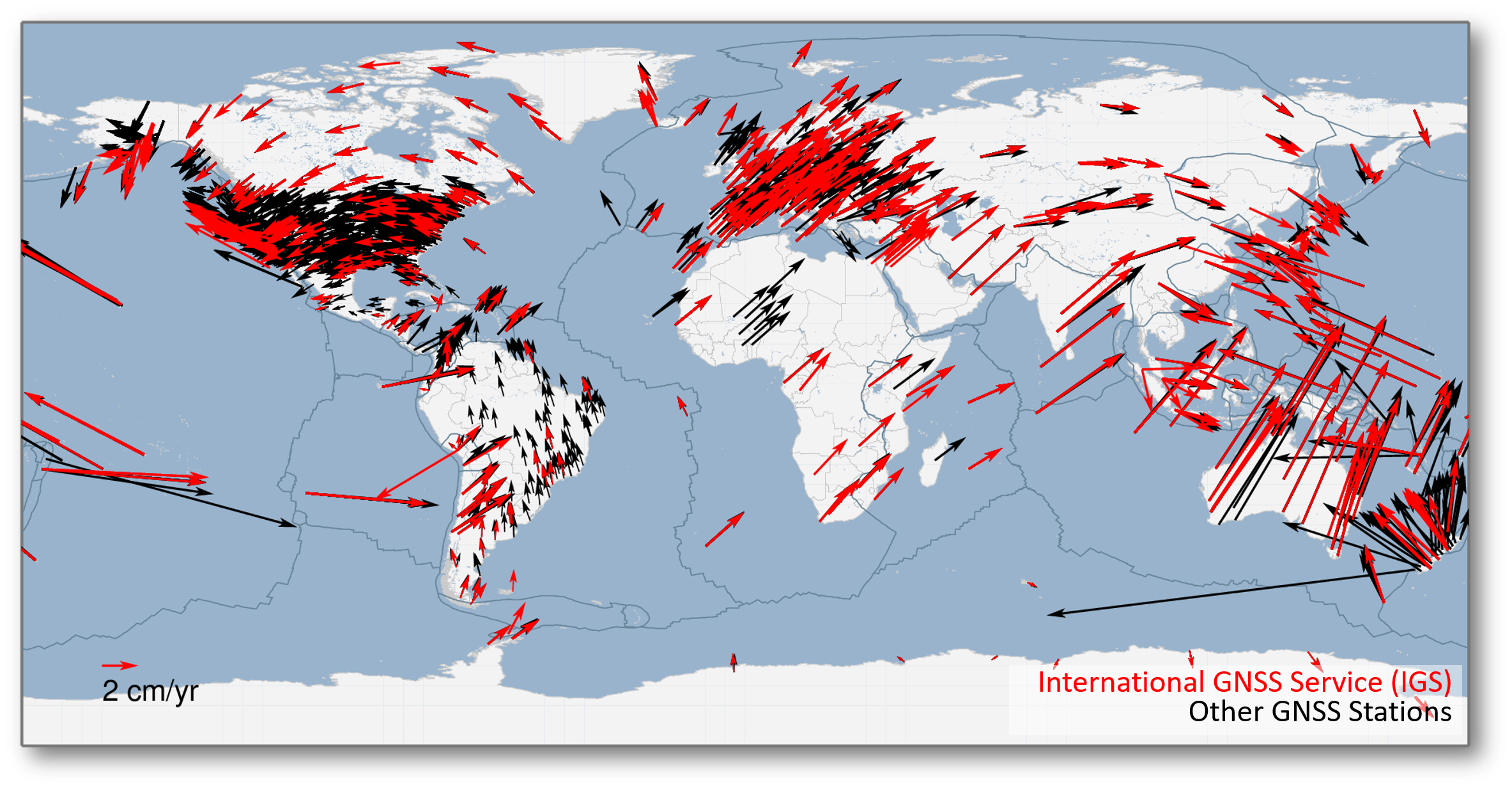
GNSS is the primary tool to determine positions on Earth's surface as well as their change in time. Because of Earth's constant motion (due to e.g. plate tectonics), the measurement of position needs accurate points of reference, which are at the foundation of every aspect in collecting and managing geospatial information. For this purpose, in Europe, one can rely on the GNSS reference stations of the EUREF Permanent GNSS Network (EPN).
EUREF is the sub-commission for the European reference frame within the International association of Geodesy. ROB is involved in EUREF since 1989 and in the International GNSS Service (IGS) since 1991 because through EUREF and IGS, we integrate Belgium in resp. the European Terrestrial Reference System (ETRS89) and the International Terrestrial Reference System (ITRS), one of the core missions of ROB.
Contribution to EUREF
GNSS data provision
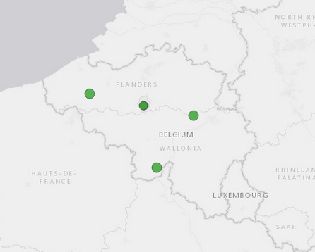
ROB operates the following permanently tracking GNSS stations (https://doi.org/10.24414/FST8-P256):- BRUS00BEL, located in Brussels at ROB, decommissioned in 2012 and providing data to both EUREF and IGS.
- BRUX00BEL, also located in Brussels at ROB, providing operationally daily, hourly, and real-time data to both EUREF and IGS
- DENT00BEL, located in Dentergem (West-Flanders), providing operationally daily, hourly, and real-time data to EUREF
- DOUR00BEL, located in Dourbes (Namur), providing operationally daily, hourly, and real-time data to EUREF
- WARE00BEL, located in Waremme (Liège), providing operationally daily, hourly, and real-time data to EUREF
EPN network coordinator and EPN Central Bureau
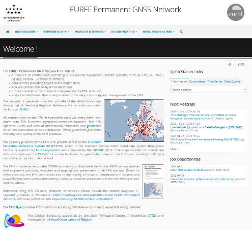
ROB's GNSS team is, since the creation of the EPN in 1995, responsible for its network coordination and EPN Central Bureau (CB). In that frame, ROB integrates new GNSS stations in the EPN, monitors the performance of EPN stations, and provides access to information concerning EPN data and data products through a dedicated web portal (https://doi.org/10.24414/ROB-EUREF-EPNCB) and several mailing lists. Part of ROB's daily activities consists also in analyzing the results of its automated processes to scan EPN data centers, retrieve data, and perform checks on the GNSS station data and metadata. The robustness of these services in operation is a continuous challenge that requires constant development and improvement of background monitoring modules. Finally, ROB sends and answers more than 1000 emails each year to notify station managers about abnormal station conditions, provide information about EPN data, help using the EPN data and products, or applying EPN guidelines.
EPN historical data center
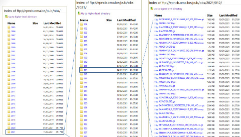
ROB maintains the EPN historical data center (https://doi.org/10.24414/ROB-EUREF-HDC) which contains the curated daily RINEX 30-sec observation data, collected since 1996, of ~500 EPN stations. The archive presently includes about 3 million GNSS observation files. These last years, considerable efforts were made to increase the Findability, Interoperability, Accessibility, and Reusability (FAIR) of the data in the EPN historical data center. Currently, the data and rich metadata can be retrieved through web pages or API avaible from the Open Data Portal.
Real-time EPN broadcaster
ROB operates a real-time EPN broadcaster that provides access to the real-time RTCM data streams of EPN stations willing to openly share their real-time GNSS data. The data are shared by using the NTRIP protocol which is based on the principle of internet radio. The ROB broadcaster supports the NTRIP v2.0 protocol. See http://igs.bkg.bund.de/ntrip/about for more information on NTRIP. To get access to the data, it is necessary to first register an account.
EPN reference frame coordinator
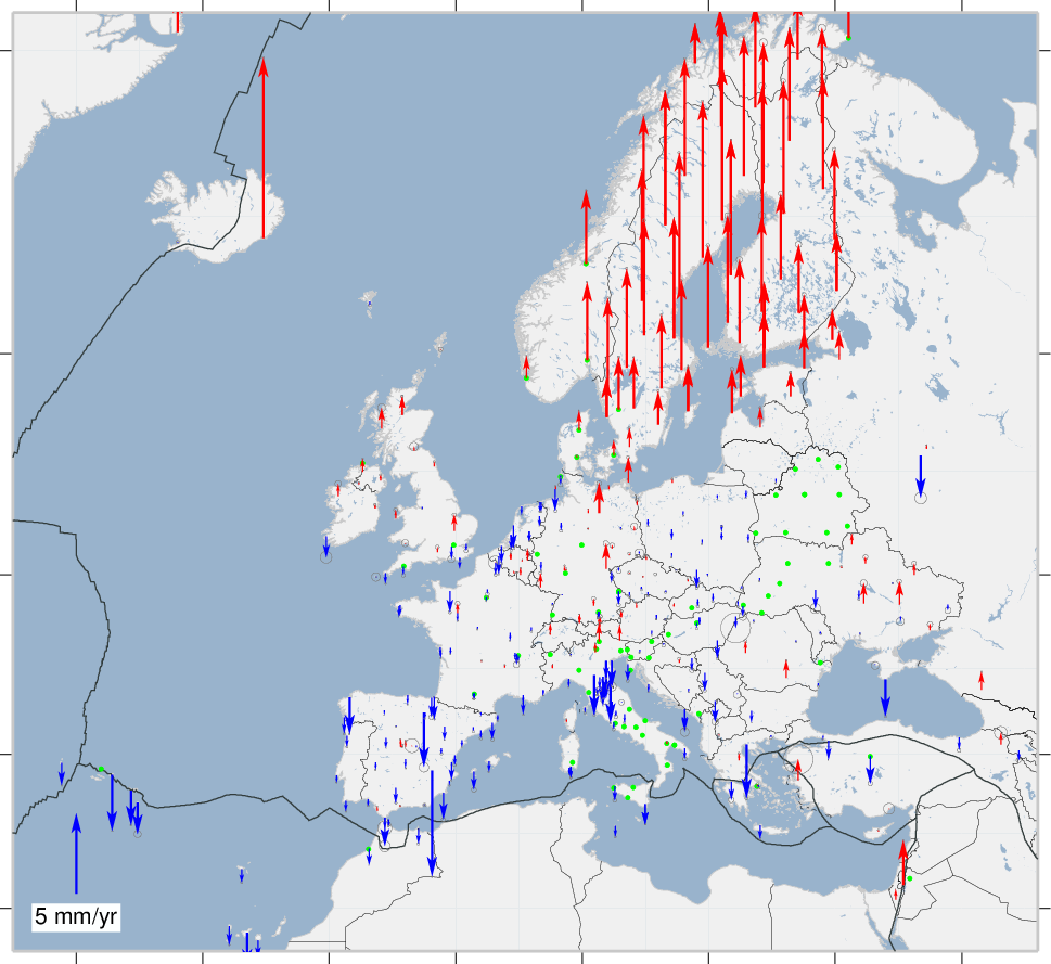
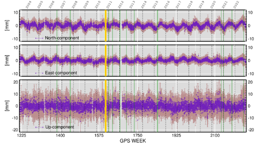
As EPN reference frame coordinator, ROB provides regularly updated long-term positions & velocities and position time series of the EPN stations (https://doi.org/10.24414/ROB-EUREF-CWWWW), which are considered as EUREF's official ETRS89/ITRS coordinates. In addition, based on a long-term monitoring of the EPN stations, ROB also provides information on which EPN stations are suitable to be used as reference stations for EPN densifications through a dedicated Tool for Reference Station Selection.
EPN analysis center
ROB computes on a daily basis the positions of a subnetwork of EPN stations as well as their hourly tropopsheric zenith path delays (https://doi.org/10.24414/FST8-P256) using the Bernese GNSS software. This computation is done in such a way that ROB provides a rapid (one day latency wrt to the GNSS observations) and a final solution (2-week latency) to EUREF. In addition, ROB is also one of the EPN Densification Analysis Centers and provides daily position solutions for a network of EPN and EPN densification stations in and around Belgium to EUREF's EPN Densification project.